Radio-Magnetotellurics (RMT) is a geophysical sounding method used to image the subsurface electrical conductivity structure. It is a variant of the magnetotelluric (MT) method but operates in the high-frequency range, typically between 1 kHz and 1 MHz.
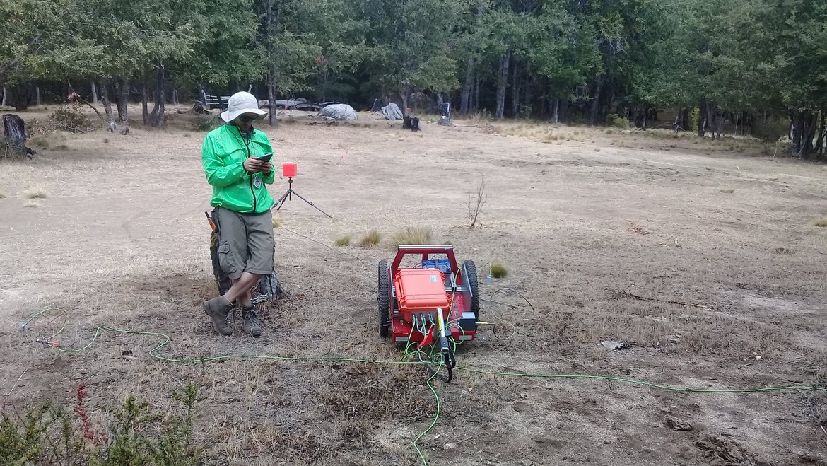
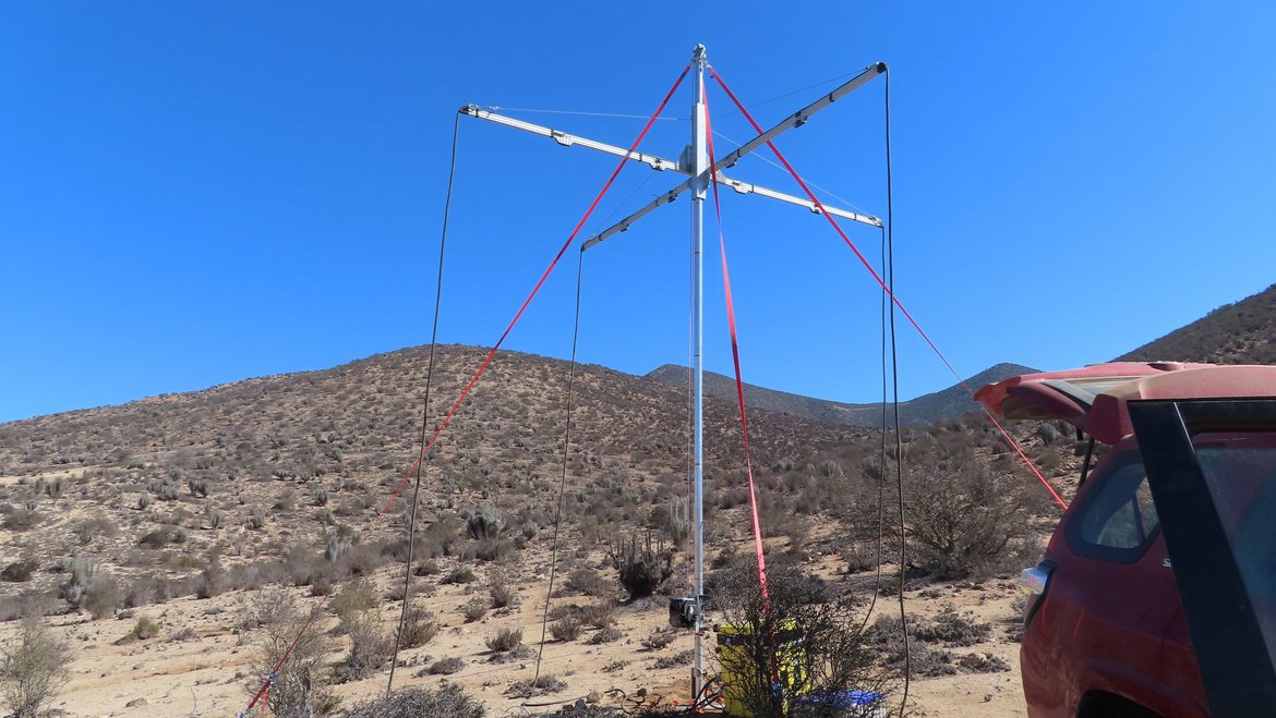
While traditional MT relies on natural electromagnetic fields, RMT uses artificial electromagnetic sources such as distant radio transmitters operating in the very-low-frequency (VLF) to medium-wave range. Thereby we depend on areas for our exploration where strong radio signals from different incidence angles are available. To overcome this limitation, the research group “Magnetotellurics” at GFZ operates a horizontal magnetic dipole transmitter. In two 5x5m2 loops it generates magnetic field variations in orthogonal directions for 8 frequencies between 1 kHz and 1MHz. Independent of the signal source, magnetic and electric field variations are recorded at the Earth’s surface. Therefore, sensors are placed on the ground which measure:
- The electric field (E-field) using grounded electrodes.
- The magnetic field (H-field) using induction coils.
For data processing, we can rely on the existing software package Emerald, which originally serves for processing of MT data with advanced statistical and physical constraints, applying some RMT specific settings.
With its restriction to high frequencies, RMT has a depth of resolution of up to 100 m, making it a prime method for imaging the depth and physical / structural properties of geological layers (CO2 degassing in the Eifel and the Eger Rift), Groundwater exploration, Mineral exploration (e.g., sulfide ores, geothermal resources) or Environmental studies (e.g., mapping contamination plumes).
Advantages of RMT are manyfold;
- higher resolution than traditional MT due to its high-frequency range and dense site spacing
- portable and cost-effective, as it requires only a small setup
- non-invasive, making it ideal for environmental and archaeological studies.
- rapid data acquisition, suitable for near-surface investigations.
Timeframe
- since 2024
Funding
- GFZ
- DFG
Principal Investigator
Involved Researchers
Cooperations
- Radic Research
Publications/Results
- Rulff, P., Weckmann, U., Kalscheuer, T., Willkommen, G., Buntin, L. M., Platz, A. (2025 online): Imaging Mofette Structures in the Ohře Rift System, Czech Republic, Using Radio-Magnetotelluric Data. - Pure and Applied Geophysics.
- Ritter, O., Patzer, C., Cruces-Zabala, J., Hemmens, E., Arend, I., Weckmann, U. (2021): Magnetotelluric and Radiomagnetotelluric measurements near Geyer in the Ore Mountains, Germany (Report on the magnetotelluric data in the project/repository folder: GEYER.2019)
- Ritter, O., Patzer, C., Cruces-Zabala, J., Hemmens, E., Arend, I., Weckmann, U. (2021): Magnetotelluric and Radiomagnetotelluric measurements near Geyer in the Ore Mountains, Germany.