

How reliable is the information from remote sensing for crop production? How can the data be used as a decision-making aid for agriculture?
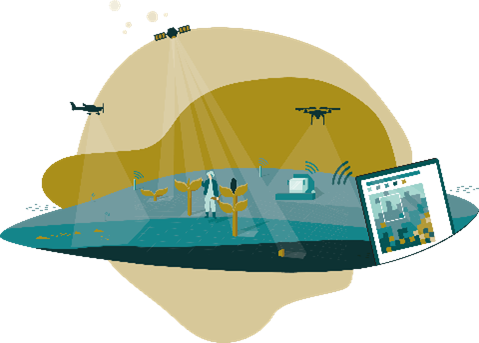
Data from remote sensing sensors on satellites, aircrafts and drones can enable agricultural businesses to increase their productivity in the future while protecting the environment and biodiversity. AgriSens-DEMMIN 4.0 serves the use of geoinformation in crop production. The project has identified specific use cases for remote sensing data in order to answer practical questions in crop cultivation using digital methods. The project is one of 14 “Digital Experimental Fields” funded by the Federal Ministry of Food and Agriculture (BMEL) to promote digitalization in agriculture in Germany.
The DEMMIN (Durable Environmental Multidisciplinary Monitoring Information Network) experimental field is located approx. 180 km north of Berlin in the federal state of Mecklenburg-Western Pomerania in the north-east German lowlands. Since 2011, it has also been part of the TERENO Observatory Northeast of the German Research Center for Geosciences Potsdam. DEMMIN is the only German test area in the Joint Experiment of Crop Assessment and Monitoring (JECAM). In addition, other sites in Saxony-Anhalt and Lower Saxony will be included as comparison sites in order to test the transferability of developed methods.
Among other use cases, we focused on crop monitoring using satellites, the detection of under-yielding areas using FieldMApp, AI-supported detection of stones on the field from drone images, and the modeling of the water balance in order to make statements about the necessity of irrigation. In addition to providing low-threshold solutions and geodata for agricultural practice, an additional focus was put on knowledge transfer and public relations work relating to the topic of “geoinformation data in agriculture”. Several field days and training courses were held together with farmers and the project was also represented at the “Green Week” in Berlin. Further information and results can be found on the AgriSens-DEMMIN 4.0 website (German language only).
Coordinated by the GFZ, AgriSens-DEMMIN 4.0 is a consortium of 8 institutions spread throughout Germany. These include federal authorities, major research centers and universities. The project is also represented in the BMEL competence network “Digitalization in Agriculture”.