The eastern flank of Mt. Etna volcano is posing the significant threat of a tsunamigenic landslide to the local population: At centimeter/year rates it is creeping and collapsing eastward into the Strait of Messina. But the reason for this instability is yet poorly understood.
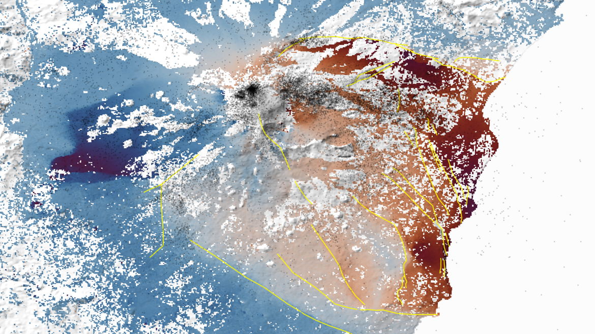
We analyze satellite-geodetic time-series from accurate positioning systems (GNSS) and radar interferometry (InSAR) of the past decade to create a 3D surface deformation field of the volcano. Using structural geology and kinematic modeling techniques we constrain the 3D-geometry of the moving blocks, which will provide important information to constrain the sliding surface at depth. A second project line focuses on the role of fluid (water, magma) and how they relate to creep transients, which is simulated by numerical modeling techniques.
Our efforts will provide important boundary conditions for Mt Etna's multi-hazard scenario modeling.