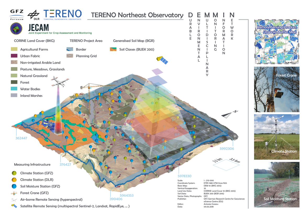
Integration of in-situ and remote sensing data (TERENO)
Land uses that operate on a large scale, such as agriculture and forestry, are highly dependent on the availability of resources. Soil quality and water availability are characteristic examples of this. Long-term observation with remote sensing data can give us a deeper insight into how strongly these resources are exposed to change.
As one of the key parameters in regional hydrological and climatological modeling, evapotranspiration is therefore given special attention in the context of long-term monitoring in TERENO, with the most precise temporal (daily) and spatial distribution possible (from point to area). In addition, further external factors influencing evapotranspiration are analyzed. The current research focus in this area is on the collection of near-surface soil, vegetation and water parameters, derived from multi-temporal and multi-sensor remote sensing data. The focus here is on the central system understanding of agricultural and other large-scale landscapes in Europe. This also applies to demonstrating the usability of remote sensing methods for administrative and economic decisions.
The main research area for much of our current research is the TERENO Northeast German Lowlands observatory (TERENO-Northeast - link). Our work is also increasingly focusing on land use in Brandenburg.
The projects of the working group currently cover the following topics:
- Deriving vegetation and soil parameters for agricultural use: APP4FARM, WHEATWATCHER, AgriSens DEMMIN 4.0, DigiMix-PA, AI4Weed
- Recording the relationship between plant physiology and spectral signals: NaTec – KRH, FeMoPhys
- Deriving and validating remote sensing land surface products: LauMon , HYPERNETS, BALTFLOODS
- Provision of a high-resolution precipitation product from X-band weather radar data: Agrohyd-X