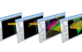
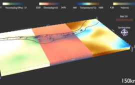
The Earth system knows no scientific disciplinary boundaries and the distribution of physical properties and the governing processes live in a continuum. Access to probing this continuum at different depth levels of the lithosphere is however limited and the different probing methods resolve variable scales. That’s why we need models! Though the majority of physical laws apply across all scales, the problem lies not only in the description of these processes, but also in the incompleteness of observations to describe inherent heterogeneities in the Earth system.
Our vision is to connect subsurface heterogeneities observed at different scales through integrated process modelling concepts linking the geological time scale with the human time scale. We therefore integrate various multidisciplinary data from geological and geophysical methods with process simulations that take physical principles into account. Only by integrating observational data into process models we can obtain digital twins of the subsurface capable of testing “what if?” questions.
We also use data science methods to quantify model uncertainties. As we aim to resolve the main characteristics of the sedimentary cover, the crust and the upper mantle jointly composing the outer parts of solid Earth, basic research on geodynamics and surface processes can be combined with aspects of applied research, such as geothermal energy generation, the underground storage of fluids, heat or energy, as well as the interaction between climate change and the water cycle. We derive digital twins of different scales and purposes to address basic geodynamic questions on the one hand, but also support the safe and sustainable use of the underground.
Questions we are exploring include:
- How can subsurface observations from different geoscientific disciplines effectively be integrated into models predictive beyond the initial databases?
- How do data-integrating 3D models of various tectonic environments such as rifts, passive and active continental margins, collisional orogens, intracontinental basins and transform boundaries differ and how to derive their geophysical fingerprints?
- What controls the thermal field of the lithosphere at which depths and how does this relate to geothermal exploration and to the dynamics of deformation?
- What controls active deformation in the lithosphere and how to distinguish between internal and external influences or between natural and anthropogenically induced processes?
- How is the current configuration related to the geodynamic history/future and what is the relationship between the long-term strength distribution (inherited) and occurring natural or man-induced deformation?
- What determines the stability of the Earth's crust and how does this relate to the occurrence of natural earthquakes but also of induced seismicity?
- How would surface processes and their changing dynamics affect the accessibility of water, energy or resources from the deeper subsurface?
- How sensitive are our models and simulations to the various input parameters and how can we fasten their build-up and quality assessment and improve their predictive capability?
4.5.1 – 4D Process Modelling
Working Group Leader: Dr. Mauro Cacace
Researcher involved: Dr. Marzieh Baes, Samuele Frigo, Mikhail Tsypin, Zsuzsanna Vatai
Projects of the Working Group:
- INITIATE I Climate Tectonics Interactions
- WBGeo I Workbench for Digital Geosystem
- HyTheC I Multidisciplinary approach to conceptual modelling of hydrothermal systems
- THC I Coupled Thermo-Hydro-Chemical Modelling
- KEM 15 I Knowledge Programme on Effects of Mining
_______________________________________________________
4.5.2 – 3D Data Integration
Working Group Leader: Dr. Judith Bott
Researcher involved: Tilman May, Alan Yu
Projects of the Working Group:
Junior Research Group

4.5.3 – Physics-Based Machine Learning for Hierarchical Monitoring Systems
Junior Research Group Leadern: Dr. Denise Degen
Researcher involved: Yulia Gruzdeva, Cristian Siegel
Project of the Working Group: Expert4KI Programm (BMBF)
![[Translate to English:] 3D Modellierung](/fileadmin/_processed_/d/c/csm_basin_a7e952b0ed.jpeg)

![[Translate to English:] 3D Modellierung](/fileadmin/_processed_/1/2/csm_GrsBK_hybrid_d61bf54b7e.png)
![[Translate to English:] 3D Modellierung](/fileadmin/_processed_/8/8/csm_Salt_a40385de6d.jpeg)
![[Translate to English:] 3D Modellierung](/fileadmin/_processed_/4/9/csm_Isotherm_b5a7de9ce3.jpeg)

![[Translate to English:] 3D structural model of the subsurface below Berlin with calculated temperature distribution in 4 km depth rliner Untergrunds mit Temperaturverteilung in 4 km Tiefe](/fileadmin/_processed_/b/c/csm_Temperaturfeld1.png_163df42a56.jpeg)


![[Translate to English:] Gewinner Posterpreis](/fileadmin/_processed_/d/6/csm_Posterpreis_Mikhail_9f1e94df54.webp)
![[Translate to English:] TU Berlin](/fileadmin/_processed_/5/e/csm_images_7e5afa23fd.png)